


Virginia From Above
Virginia From Above
I’m fortunate to live in Central Virginia where the rolling hills of the Piedmont act as an artificial border between the eastern and western portions of the state. It’s less than an hour drive to the Blue Ridge Parkway or Shenandoah National Park and a little over a two hour drive to the Atlantic Ocean at Virginia Beach, with tons to explore in between and beyond. I’m an avid biker (motorcyclist) so therefore, by default, I enjoy road trips. I use the bike more as a tool than I do as a toy, so I can explore and see different parts of the state. I’m a pilot by trade and both offer unique opportunities to view Virginia from above.
I’m more of a mountain man than a city slicker, which is a little contradicting since I spend a few days a week in busy airports and big cities. I appreciate the fact that Virginia has some of the best of both. There are beautiful mountains that please the eye and soul and great cities with so much to do. Whether riding on meandering, winding blacktop along the peaks and ridge lines of mountains or looking down from 30,000 feet inside the cockpit, I’m constantly in awe and reminded of how fortunate I am to live in such a wonderful location. Some of the sights I see might not necessarily be unique to Virginia, but I still wouldn’t want to live anywhere else.
 Most people don’t realize how expansive Virginia really is. From the Easten Shore on the Atlantic Ocean to the far western reaches of Appalachia in Southwest Virginia is a distance of over 400 miles. Depending on what route you take, there are just five states between Virginia and California. When flying on an arrival in Washington, D.C. or New York City from the southeastern states, oftentimes we fly right over Buckingham County, the geographical center of Virginia. In the winter months when the cold, dense air allows for almost unlimited visibility, at night you can see the lights of Cape Charles to the east and pinkish-orange lights on the ski slopes at Snowshoe, West Virginia simultaneously. In other words, you can see across the entire state of Virginia, and beyond. Just by the lights, I can pick out Blacksburg, Charlottesville, Culpeper, Harrisonburg, Lynchburg, Norfolk, Richmond, Roanoke, Staunton, Waynesboro and dozens of other towns. I can touch them all with my fingertip from a single location.
Have you ever witnessed two sunsets? The sunsets over the Blue Ridge make magical moments for anyone watching from their backyard, office, or a plane. One evening, while taxiing out of Charlottesville for our departure to Chicago, the sun slowly dropped below the Appalachian Mountains, casting a shadow on everything to the east. The sun had set. A few minutes later, we took off and as we climbed the sun reappeared on the western horizon before dipping below the Allegheny Mountains, which were now directly in front of us. The sunrises can be equally dramatic. Early morning departures out of Newport News, Norfolk, and Richmond or Washington, D.C. when eastbound provide vivid pastel hues in the sky while the first rays of sun hitting the Atlantic Ocean and the Chesapeake Bay flicker like thousands of shimmering specks of gold.
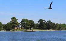
Flying over the Chesapeake Bay between the mainland and Eastern Shore is a trest itself, no matter the time. The constantly shifting sandbars give birth to different depths of water before they’re washed away and rebuilt in a different location. The changes in the water’s coloration is sometimes more reminiscent of what one would expect in the Caribbean. Deep and light blues are mixed in the greys and purples with the yellow and white sand. After heavy rains, the flooded rivers that deposit their dirt, mud, and silt into the Bay turn it an ugly brown, but by nature’s design, it will soon return to its pristine image worthy of a wall-mounted canvas.
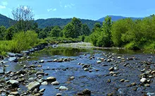
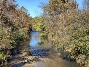
Speaking of muddy waters, have you ever seen a single river that runs as two? The Meeting of Waters (Encontro das Aguas) is the confluence where the Rio Negro runs into the Amazon River in Brazil. For several miles, the black and brown river waters do not mix and the rivers appear to flow as separate bodies of water. The same is true after heavy rains affect one of either of the Potomac and Shenandoah Rivers. The confluence of these two rivers is in Harpers Ferry, West Virginia where downstream the Potomac forms the border between Maryland and Virginia all the way to the Chesapeake Bay. When one river is running red with mud and the other is clear, below the confluence the rivers seemingly run as two distinct rivers, rather than the one it actually is. It’s quite a sight to see.
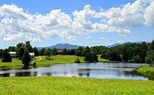
 Virginia is home to several medium and large-sized recreational lakes. During the warmer months and especially around holidays, the hundreds or even thousands of people on the waters of Claytor Lake, John H. Kerr Reservoir, Lake Anna, and Smith Mountain Lake can easily be seen from a high cruising altitude. With a sharp eye, at lower altitudes, one can pick out brightly colored canoes, kayaks, or rafts floating down slow-moving rivers. On clear days in Virginia, you can truly understand how watersheds work. Flying over Central Virginia, if you know where to look, you can locate Beautiful Run. Beautiful Run empties into the Robinson River, which runs into the Rappahannock River, which runs into the Chesapeake Bay, before emptying into the Atlantic Ocean north of Virginia Beach. In the western portion of the state Camp Creek dumps into Little River, which empties into the New River, which becomes the Kanawha River at the confluence with the Gauley, before merging with the Ohio, ending up in the Mississippi, and thus its terminus in the Gulf of Mexico. How crazy is it to think that a drop of water from a small creek in southwest Virginia can end up in the Gulf of Mexico?
While we’re still on the topic of water, did you know Virginia has several ferries? Ferries don’t often come to one’s mind when they’re contemplating how to get around some of the water communities of Virginia. The Jamestown-Scotland Ferry has two boats that run continuously. Tangier Island Cruises and the Tangier-Onancock Ferry will transport you from the Eastern Shore or the Northern Neck to the tiny fishing island in the middle of the Chesapeake Bay. You can drive in a tunnel under the water, or take a ferry across the Elizabeth River between Norfolk and Portsmouth. White’s Ferry, just north of Washington, D.C. crosses the Potomac River, guided by cables. The Potomac Water Taxi in Alexandria gives tours around D.C. One of the reasons I love flying into New York City on a nice day is to see all the boats and ferries, including the gigantic orange Staten Island Ferries, darting to and fro with long lines of wake zig-zagging into each other. While obviously not as dramatic in Virginia, I still enjoy watching all of the boats out in the water.
One of the neatest things to witness is the arrival or departure of a fleet of Navy ships coming in or going out of Norfolk Naval Station, the largest naval base in the world. It gives me goosebumps to think of the mighty power of an entire carrier group sailing. While the carrier is the crown jewel of the fleet, amphibious assault ships, combat ships, destroyers, landing ships, patrol ships, and transport ships make up the entire group. The whitewater wake churned up lasts for miles. More often than not, Seahawk helicopters are flanking the convoy on most sides. One of the most awesome sights I’ve seen while flying occurred just off the coast of Virginia. Flying down to Norfolk from New York one night, the Navy was engaged in live-fire exercises. Red tracers were shooting high into the sky and we could see orange bursts on the horizon line, which we assumed were the large deck guns being fired. For the passengers, it was certainly a once in a lifetime opportunity to witness that type of show.
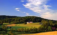
Flying above Virginia is kind of like a virtual pass to your own contour map of the state. It develops a greater appreciation for the hills, mountains, rivers, and the geological forces that have created this great place. Burkes Garden is a place that you can read about, but if you haven’t been inside of it, or flown over it, it’s difficult to actually grasp the features of the surrounding terrain. Sometimes I spend quite a bit of time looking out of the window trying to find places on the ground I’ve been or places I want to explore. I’m always looking for new locations to go for a bike ride, camp, fish, float a kayak or canoe, or hike. I’ve even scoped out distilleries, orchards, pumpkin patches, and wineries I didn’t know existed. All from simply looking out of the window. When I hike to the top of places like Old Rag Mountain, the summit of Bearfence Mountain, or the face of Stony Man Mountain, it puts the accomplishment into greater perspective when viewed from above.
Taking off out of Charlottesville, Roanoke, Tri-Cities, or even Richmond and D.C. headed westbound on foggy mornings gives you the feeling like you are on top of the world, which in a sense you are when flying. Since fog layers are usually just a few hundred to several hundred feet thick, you rapidly pop out on top leaving the rest of the world out of view, except the magnificent hills and mountains which are clearly visible. It’s quite a sight to behold and when atmospheric conditions are perfect for the formation of fog in the valleys, it’s one of my favorite views. Sometimes I’ll leave at first light on a bike trip up to the Blue Ridge Parkway or Skyline Drive when it’s foggy at home. Sure, the bike gets trashed from the mixing of the water vapor and road grime, but it’s 100% worth it when riding on top of the fog under a clear, sunny sky.
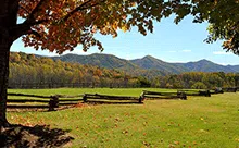
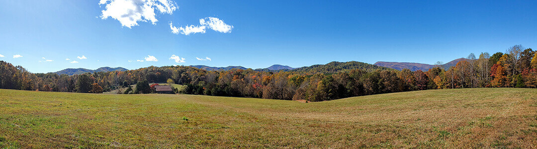
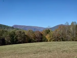
We’re lucky in Virginia to have four distinct seasons. I’m even luckier because I get to witness the changes each season brings from an aerial perspective. It’s a toss up between fall and spring if asked what my favorite season is. I love mid-October through mid-November when the leaves across the state are changing. When I was a Flight Instructor at Charlottesville-Albemarle Airport, each year a sorority from UVA would come out for aerial tours of the Blue Ridge when the leaves on the mountains were at their peak. For two days straight I’d do nothing but fly over the mountains. On a flight from Washington-Dulles to Roanoke one November, I amended our final altitude to less than half as high as we usually flew. Our standard filed route took us right over Skyline Drive and the Blue Ridge Parkway most of the way. We flew low and a little slow just to take in the scenery. Have you ever done a corn maze? There are several in Virginia every year and some, such as Liberty Mills Farm in Somerset, carve out a different themed design every year. Is it cheating if I take a picture from the air and then go try it?
In the winter, after a heavy snow, if I’m lucky enough to fly over when the skies have cleared and a full moon is out, the reflection of the snow lights up the ground almost as clear as the sun during the day. Snow and ice capped trees at the higher elevations, whose cold air keeps the winter precipitation lingering when it has melted below, reminds me of the Rockies, whose snow can often be seen year-round. If you like Christmas lights, they’re even better from the air!
In the spring, as crops grow, the Piedmont and Shenandoah Valley become a patchwork quilt of colors. In the southeastern portion of the state, fields of white indicate the cotton bolls have bloomed. The mountains burst with pink, purple, and white flowers. Spring turns to summer too quickly for me, but who doesn’t love fireworks? You know what makes them even better? Watching them from the sky. Flying around the Fourth of July is reminiscent of an active battlefield. For as far as you can see in every direction there are mini explosions and flashes of every color of the rainbow.
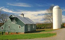
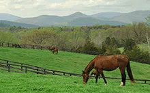
I grew up in the country, yet I find myself in cities all the time for work. Cities are their own wonders of engineering feats with tall skyscrapers and fancy architectural marvels, which I thoroughly enjoy staring at in amazement. Flying over the Golden Gate Bridge in San Francisco, the Gateway Arch in Saint Louis, the Sears Tower of Chicago, or by the Washington Monument in D.C. never gets old. Notice I said “by” the Washington Monument. The airspace over Washington, D.C. is prohibited to enter by anyone other than authorized military personnel and woe to the wayward pilot that violates that! But… I still live in and love the rural areas of Virginia. Flying over rural parts of the state almost makes me feel as though I’m not at work, but still close to home, which in a sense, I am. In the spring, it’s easy to spot flocks of snow white sheep in bright green fields. In the evening, long lines of cows can be seen heading back to the barns. The rectangular housing of chicken and turkey farms can be easily visible for fifty miles. Cut rows of hay and combines harvesting corn remind me even in the sky, I’m still connected to the land.
In contrast to all the beautiful things to see over Virginia, nature’s devastation can be amazing in its own way. I’ve flown over the state after hurricanes have dumped copious amounts of water causing the rivers to swell well beyond their banks. Viewing fields, houses, streets, and everything in between under water from the air gives greater understanding of powers that humans can not hold back. I’ve seen paths tornadoes have cut through woods. Several years ago, while climbing out of D.C., I flew over a forest fire in the central section of Shenandoah National Park where fire crews were having difficulty gaining the upper hand. It was a clear day and the burn area was clearly visible, minus what the smoke was covering. I took some pictures and sent them to the park and they were very grateful, telling me they would be using them for the next command briefing.
There are so many things I haven’t touched on; Civil War battlefields, plantations on the James River, mile long coal trains hugging the New River, and much more. If you’ve ever lived in Virginia, you’re already aware of everything it has to offer. If you’re simply flying over Virginia, you’ll probably see something that will pique your curiosity. If you’ve never done either, you don’t know what you’re missing!
Additional Articles