


home / virginia resources / charlottesville / Charlottesville Hiking and Trails
Charlottesville Hiking and Trails
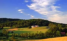
More About Charlottesville
Charlottesville’s newest trail, Schenk’s Greenway, is ideal for hiking and biking on its crushed-gravel surface. Pen Park Fitness Trail offers 20 stations for a variety of stretching and fitness opportunities while jogging or walking. McIntire Park plays host to a number of trails along the creek and through the park’s forests.
Greenleaf and Forest Hills Parks offer smaller trails through heavily wooded areas in Charlottesville.
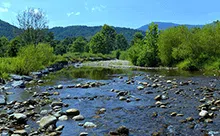
The beauty of Virginia’s woodlands has led to the creation of several national parks and forests in the area: George Washington National Forest, Shenandoah National Park, and Jefferson National Forest. Such governmentally protected areas provide an ideal location to hike.
Though difficulty levels vary from forest to forest and trail to trail, the outstanding view of the various mountain ranges which traverse central Virginia is unwavering.
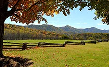
The Skyline Drive, famous for its breathtaking views, provides access to Shenandoah National Park, a hotspot of Virginia hiking. Proving over 500 miles of hiking trails, Shenandoah National Park includes stretches of the renowned Appalachian Trail, and several swimming holes fed by mountain springs. The two main trails of Shenandoah National Park, Riprap Hollow and Turk Mountain, are 9.5 and 10.4 miles, respectively. These trails are fairly difficult, and camping in the area is poor or nonexistent.
One of the largest stretches of park forestry in the eastern United States is located primarily in Virginia. After the George Washington and Jefferson National Forests were combined, the park swelled to encompass almost 1.8 million acres of public land.
Hiking trails through this forest vary in difficulty, but one can be certain to always find picturesque views. Trails range from 2.5 to 15.5 miles through mountain passes. Though a few of the trails are considered very easy, the longer trails are difficult even for the most experienced hiker, and should be hiked with caution and a great deal of preparation beforehand.
These trails are moderately secluded and have great views of the photogenic foothills of the Blue Ridge Mountains, with several campsites carved into the hills. While most of the hikes have average to great camping spots, a few have terrain which prevents camping; this should be taken into account.
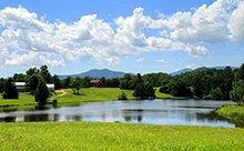
The James River Trail is an alternative to difficult, hilly mountain trails and provides a view of the photogenic river. It includes the incredible Boulevard Bridge walkway.
Thirty miles of some of the most difficult hiking trails of central Virginia can be found in parts of the George Washington National Forest, in the area surrounding Wintergreen Resort. Views include Shamokin Falls and Torry Ridge. Though the trail is a relatively mild hike, especially compared to central Virginia’s common mountainous trails, there are no campsites along the heavily-trafficked trail.