


home / virginia real estate / riverfront / rivers
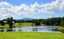
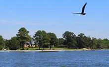
Virginia Rivers
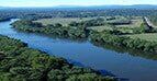
James River
At 348 miles long, the James River is the 12th longest river in the United States that remains entirely within a single state. The river forms in the Appalachian Mountains near Iron Gate and flows into the Chesapeake Bay at Hampton Roads.
Potomac River
The Potomac River is Virginia’s most northerly waterway, defining the border between Maryland and Virginia. The Potomac provides its vast 300 mile+ region with a primary source of drinking water since the 1800s.
Rappahannock River
The Rappahannock River traverses the northern part of Virginia from the Blue Ridge Mountains in the west to the Chesapeake Bay in the east. The river is also frequently noted for its oysters, as those that thrive in the estuary of the Rappahannock are the least salty on the East Coast.
Rivanna River
With tributaries originating in the Blue Ridge Mountains, the peaceful Rivanna River itself comes to fruition just northeast of Charlottesville in Albemarle County. Part of the watershed of the Chesapeake Bay via the James River, this 42.1-mile-long river is a source of drinking water for the Charlottesville area.
Rockfish River
Traversing central Virginia, the Rockfish River is a 28.7-mile-long tributary of the James River, via which it is part of the Chesapeake Bay Watershed. The confluence of the North and South Forks in Nelson County forms the Rockfish River.
Shenandoah River
A tributary of the Potomac River, the Shenandoah etches a scenic path through the Allegheny and Blue Ridge Mountains through the Shenandoah Valley via two major forks, beginning in Rockingham County and flowing north-easterly until it meets the Potomac in Maryland.